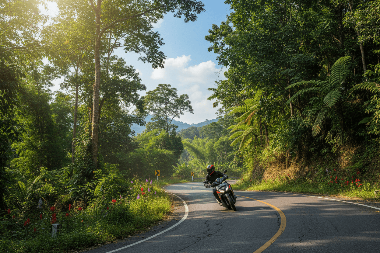
Doi Inthanon National Park sits 90 km southwest of Chiang Mai's Old City via Route 108 and Route 1009, a 90-minute scooter ride from any Tha Phae Gate or Nimman rental shop. The summit at 2,565 m is the highest point in Thailand, the foreigner park entry fee is 300 THB plus 150 THB for the motorbike (cash, collected at the Chom Thong gate), and the park covers 482 sq km of cloud forest, six headline waterfalls, and Karen and Hmong villages anchored by the Royal Project Inthanon. Ride budget for a Honda PCX 160 day trip: 250-450 THB rental, 300 THB park fee, 250-300 THB fuel.

Key Takeaways
- Distance from Chiang Mai: 90 km southwest of the Old City via Route 108, with the park headquarters at Chom Thong (58 km out) and the Route 1009 climb starting just past the gate; allow 90 minutes one-way on a 150-160cc maxi scooter.
- Park entry fee: 300 THB foreigner, 150 THB child, plus 150 THB for the motorbike (cash only at the Route 1009 gate); the ticket is single-day and covers every named-entity stop inside the park.
- Summit altitude: 2,565 m at the actual peak (Thailand's highest), with the Royal twin pagodas (Phra Maha Dhatu Naphamethanidon and Phra Maha Dhatu Naphaphon Phumisiri) sitting at 2,200 m on a manicured Royal terrace just below.
- Headline attractions: Mae Ya Waterfall (Thailand's tallest at 280 m), Wachirathan Waterfall (70 m thunderous drop), Mae Klang Waterfall, Sirithan Waterfall, the Kew Mae Pan Nature Trail (3 km, mandatory Hmong guide), and the Ang Ka Nature Trail (360 m boardwalk through cloud-forest moss).
- Best season: November to February for clear skies, sea-of-clouds visibility, and 8-12 degrees C summit temperatures; December and January nights drop near zero with reported frost above 2,400 m, the only place in Thailand it happens.
- Royal Project Inthanon: cool-climate strawberry, coffee, and cut-flower research station near the Hmong village of Ban Khun Klang, founded under King Bhumibol's hill-tribe alternative-crop programme; entry is included in the park ticket.
Why visit Doi Inthanon as a destination?
Doi Inthanon National Park is the highest-altitude protected area in Thailand and the only place in the country where you can stand in cloud forest at 2,565 m, watch frost form on a January morning, and meet the Karen and Hmong communities who farm the slopes under the Royal Project Inthanon alternative-crop programme. The park covers 482 sq km of mixed evergreen and dipterocarp forest, including Thailand's only sphagnum peat bog at the summit, and protects an unusually dense bird population for the country: more than 380 recorded species, including endemic green-tailed sunbirds and ashy-throated warblers. The peak itself is named for King Inthawichayanon, the last king of Chiang Mai, whose ashes are interred at a 1.5 km marker below the summit boardwalk.
History matters here in a way it does not at most Thai parks. The mountain anchored the watershed dispute that helped trigger the 1933 forest-protection movement; it became Thailand's 49th national park in 1972; and the late King Bhumibol's Royal Project Inthanon, founded in 1979, switched the local Hmong economy from opium poppy to cool-climate strawberries, coffee, and cut flowers within a generation. A visit threads through all three layers: the British-era logging trails on the lower slopes, the mid-mountain hill-tribe villages now growing cherry tomatoes and arabica, and the post-1972 conservation infrastructure that keeps the cloud-forest peat intact. For the ride mechanics (Route 1009 gradient, bike-class fit, descent technique), see the dedicated Doi Inthanon motorbike ride guide; this guide covers what you do once you arrive.
The park separates cleanly into three altitude bands. The 300-1,000 m lower slopes around Chom Thong host the entry station, Mae Klang Waterfall, and the trailhead villages; this is where most day-trip groups spend their morning. The 1,000-2,200 m middle band is the hill-tribe and Royal Project zone, with Ban Mae Klang Luang (Karen, terraced rice) and Ban Khun Klang (Hmong, strawberries and coffee) along Route 1009. The summit band above 2,200 m is the cloud-forest belt, with the twin pagodas, the Ang Ka Nature Trail, and the actual 2,565 m peak. A single-day visit can sample one stop from each band; multi-day visits unlock the deeper Kew Mae Pan and Pha Dok Siew trails plus the homestay options in the Karen villages.
Top attractions and how to combine them
The park's headline attractions cluster along Route 1009 and a handful of signposted side roads, with everything inside the Chom Thong gate covered by the single 300 THB foreigner ticket. The five must-do stops are the twin pagodas at 2,200 m, the Ang Ka Nature Trail at 2,565 m, Wachirathan Waterfall at the 22 km mark on Route 1009, the Kew Mae Pan Nature Trail trailhead near the Royal Project, and Mae Ya Waterfall on the Route 1284 side road that branches off near Mae Klang. Less-photographed but equally rewarding: the Royal Project Inthanon visitor centre, Ban Khun Klang's morning Hmong market (06:00-09:00, fresh strawberries in December and January), and the Pha Dok Siew waterfall trail that needs a Karen homestay guide.
How to reach Doi Inthanon by motorbike
The fastest and cheapest way to reach Doi Inthanon National Park from Chiang Mai is by motorbike: 90 km southwest from the Old City via Route 108 to Chom Thong (58 km), then Route 1009 climbs the final 48 km from the park gate to the summit. Total ride time on a 150-160cc maxi scooter is 2-2.5 hours one-way, with sustained 6-9% gradients on Route 1009 between Wachirathan Waterfall and the twin pagodas. Fuel cost for the 200 km round trip is 250-300 THB on a Honda PCX 160. The alternative ridge road, Route 1284, branches off near Mae Klang and reaches Mae Ya Waterfall and the Pha Dok Siew Karen homestays without the steepest summit hairpins; pair it with Route 1009 for a non-repeating loop on the descent.
Bike-class choice tracks the 6-9% gradient. A Honda Click 125 manages the climb solo in dry weather but engine-brakes weakly on the 48 km descent and can stall on the steepest hairpins above 2,200 m two-up. A Honda PCX 160 or Yamaha NMAX (250-450 THB per day) is the comfortable solo or light-two-up minimum. A 250cc-plus manual (Honda CB300, Honda CRF300 Rally, 500-1,200 THB per day) is the right tool if you're touring two-up with luggage or planning to combine Doi Inthanon with the Samoeng Loop on the same week. The Motorbike Rental Chiang Mai (2026) guide covers the Old City and Nimman price baselines and walks through the four-step booking flow.
Where to stay inside or near the park
The two practical accommodation bases are the park's own bungalows and campground at the headquarters near Chom Thong, and the Karen homestays in Ban Mae Klang Luang and Ban Pha Mon. Park bungalows run 1,000-3,000 THB per night for 2-6 person units, are bookable through the official Department of National Parks reservation portal, and sell out months ahead for the December-January peak. The campground accepts walk-ins (60 THB per person plus 150-300 THB tent rental) but has no online booking; arrive before 16:00 to claim a pitch with views over the lower valleys. Karen homestays are the more cultural option: 600-1,200 THB per night including dinner and a guided next-morning trail walk to a Royal Project plot or a side waterfall like Pha Dok Siew.
The mid-mountain Royal Project Inthanon Royal Agricultural Station also runs visitor accommodation in cool-climate themed bungalows (1,500-3,500 THB), with cherry-blossom photo opportunities in late January and February. For a full-amenity hotel base, the Chom Thong town strip on Route 108 has 600-1,500 THB roadside guesthouses and a couple of mid-range 2,000-3,500 THB resorts. Most riders skip Chom Thong and base in Chiang Mai's Old City instead, riding out at 07:00 and returning by 19:00; that approach trades the early-morning sea-of-clouds opportunity for a Tha Phae Gate dinner and a softer bed. For broader Chiang Mai-side accommodation context, the Chiang Mai 5-Day Itinerary covers Old City, Nimman, and Santitham positioning.
A two- or three-day stay unlocks the parts of the park that day-trippers cannot reach. Day one covers the headline waterfalls (Mae Klang, Wachirathan, Sirithan, Mae Ya) and the twin pagodas. Day two does the Kew Mae Pan trail at sunrise (the 06:30 start catches the sea of clouds at its densest), the Royal Project visitor centre, and the Ban Khun Klang Hmong market. Day three rides the alternate Route 1284 ridge road to the Pha Dok Siew Karen trailhead, with the descent looping back through Chom Thong for fuel and lunch. The park's three altitude bands deliver three different experiences in three days; a single-day visit only samples the headline highlights.
When to visit and the seasonal rhythm
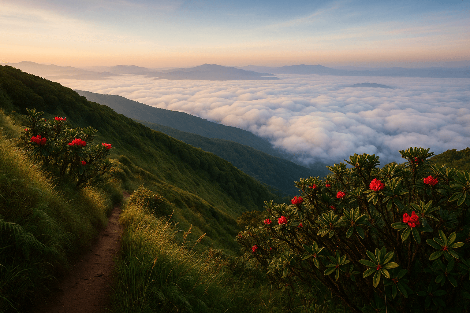
The best season for Doi Inthanon National Park is November to February, the cool-dry window when summit visibility is highest, the Mae Klang and Wachirathan waterfalls still flow strongly from the late-monsoon top-up, and the Kew Mae Pan trail's rhododendron groves bloom across late January. Daytime summit air sits at 8-12 degrees C, with overnight lows of 2-5 degrees C and reported frost above 2,400 m on the coldest December and January nights. The Royal Project's cherry-blossom display in late January and the Ban Khun Klang strawberry harvest from December into February pair well with a homestay overnight. Sea-of-clouds visibility from the Ang Ka boardwalk is highest in the 05:30-07:30 window during this season; arrive early.
March to early May is the hot-dry season. Old City highs of 35-40 degrees C drop to 12-18 degrees C at the summit, but a haze layer can blanket the photo views by mid-morning. The Kew Mae Pan trail closes for management on May 31 each year and reopens November 1, so March-May is the last window before the wet-season closure. May-October monsoon makes the waterfalls thunderous (Wachirathan and Mae Ya peak in August and September) but afternoon thunderstorms above 1,500 m are predictable: leave Chiang Mai by 06:00, summit by 11:00, and start the descent before 14:00. Cloud-forest fog above 1,800 m can drop visibility to 20 m in minutes; ride conservatively. The Best Time to Visit Chiang Mai guide breaks the seasons down month by month.
Combining Doi Inthanon with other Chiang Mai trips
Doi Inthanon pairs well with two adjacent trips on a longer Chiang Mai stay. The closest pair is the Bua Tong Sticky Falls (Bua Thong, 60 km north of the city in Mae Taeng district), reached on the descent via Route 108 then Route 1001; it is a non-park free site with limestone-deposited grippy rock that walkers climb directly up the cascade. The further pair is the Mae Sa Valley waterfall route (100 km, 4-5 hours) on a separate rental day, which loops west of the Old City through the Mae Sa Valley and the Royal Project Mae Sa, giving you the same Royal Project context at a softer altitude. For waterfall completism, the Top 10 Waterfalls Near Chiang Mai post ranks every cascade by motorbike-distance from the Old City.
Beyond the day-trip orbit, the park also serves as the altitude rehearsal for the bigger northern Thailand routes. The 600 km loop (1,864 curves on Routes 1095 and 108) and the Pai Loop on Route 1095 (130 km, 762 curves) are multi-day touring routes; ride Doi Inthanon first to test bike-class fit, descent technique, and your tolerance for sustained 6-9% gradients before committing to three nights on a loop. The Best Day Trips From Chiang Mai post covers the alternatives if Doi Inthanon's altitude isn't the right fit, including the ethical elephant sanctuary options in the Mae Taeng valley and the temple-focused Best Temples in Chiang Mai loop that anchors at Wat Phra That Doi Suthep.
For visitors building a multi-day Chiang Mai plan from scratch, the Chiang Mai 5-Day Itinerary and the Chiang Mai Old City Guide cover food, temples, and base accommodation; pair them with one Doi Inthanon day, one Samoeng or Pai Loop day, and one rest-and-laundry day for a manageable weekly rhythm. The two most-skipped details in Doi Inthanon planning are reserving park bungalows ahead through portal.dnp.go.th for December-January weekends, and packing a fleece for the summit; both fixes cost nothing in advance and prevent the two most common day-of regrets.
Frequently Asked Questions
How far is Doi Inthanon National Park from Chiang Mai?
Doi Inthanon National Park is 90 km southwest of Chiang Mai's Old City via Route 108 to Chom Thong (58 km) and then Route 1009 into the park. Allow 90 minutes one-way on a 150-160cc maxi scooter, plus 30 more minutes for the climb from the park gate to the 2,565 m summit. A round-trip day from the Old City covers 200 km and runs 9-10 hours including stops.
What is the foreigner entry fee for Doi Inthanon National Park?
Foreigner entry costs 300 THB per adult and 150 THB per child, plus 150 THB for the motorbike, collected in cash at the Route 1009 gate above Chom Thong. The single-day ticket covers every park-internal stop including the twin pagodas, the Ang Ka Nature Trail, and Mae Klang, Wachirathan, Sirithan, and Mae Ya waterfalls. The Kew Mae Pan trail adds a 200 THB Hmong guide fee paid separately at the trailhead.
Do I need a guide for the Kew Mae Pan trail?
Yes. The Kew Mae Pan Nature Trail mandates a local Hmong guide for all visitors, paid 200 THB at the trailhead near the Royal Project Inthanon. The trail is open November 1 to May 31 and closes June through October for management. The Ang Ka Nature Trail at the summit, the twin pagodas terrace, and the headline waterfalls do not require guides and can be explored independently.
What is the best time of year to visit Doi Inthanon?
November to February is the best season: clear skies, 8-12 degrees C summit air, peak sea-of-clouds visibility, and the Kew Mae Pan rhododendron and Royal Project cherry-blossom blooms in late January. December and January nights drop near zero with reported frost above 2,400 m. June to October is rideable but afternoon thunderstorms above 1,500 m demand a 06:00 start and a 14:00 descent rule.
Can I stay overnight inside the park?
Yes. The park headquarters at Chom Thong runs bungalows (1,000-3,000 THB) bookable through portal.dnp.go.th, plus a 60 THB-per-person campground that accepts walk-ins. Karen homestays in Ban Mae Klang Luang and Ban Pha Mon (600-1,200 THB including dinner and a guided morning walk) are the more cultural option. December and January weekends sell out months ahead; book early.
What is the Royal Project Inthanon?
The Royal Project Inthanon is the Doi Inthanon Royal Agricultural Station, founded in 1979 under King Bhumibol's hill-tribe alternative-crop programme. It switched the local Hmong economy from opium poppy to cool-climate strawberries, coffee, cherry tomatoes, and cut flowers within a generation. The visitor centre near the Royal twin pagodas has gardens, a cafe, a Hmong market, and accommodation in themed bungalows; entry is included in the park ticket.
Is Doi Inthanon worth it as a day trip versus a multi-day stay?
A single day samples the headline highlights: Mae Klang and Wachirathan waterfalls, the twin pagodas, the Ang Ka summit boardwalk, and Mae Ya on the Route 1284 side road. Two or three days unlock the Kew Mae Pan trail at sunrise, the Pha Dok Siew Karen trail, the Ban Khun Klang Hmong morning market, and a Royal Project overnight. Day-trippers see the park; multi-day visitors meet the people who live in it.
Plan your Doi Inthanon day from Chiang Mai
Rent a Honda PCX 160 or Yamaha NMAX from any Chiang Mai motorbike rental shop in the Old City or Nimman at 250-450 THB per day, leave Tha Phae Gate by 07:00, and reach the Chom Thong gate (58 km, Route 108) by 08:30 with a coffee stop. Pay the 300 THB foreigner fee plus 150 THB motorbike fee at the Route 1009 booth, climb the 48 km to the 2,565 m summit via Mae Klang Waterfall, Wachirathan Waterfall, the Royal Project Inthanon, and the Royal twin pagodas, then descend through Mae Ya Waterfall on the Route 1284 side road. Combine the same rental week with the Samoeng Loop and an overnight in Pai for a full northern Thailand mountain trio. Compare verified Old City and Nimman shops, see real renter reviews, and lock in your bike at Byklo, with free hotel delivery across Tha Phae Gate, Nimman, and Santitham in 2026.